Last Sunday I went on a short hike to Sulphur Mountain and Crater Hill, both of which are in the Hayden Valley. The two mountains are surrounded by a thermal area, which is then surrounded by the expansive valley. There was a bubbling thermal pool, and several mudpots. The stark contrast of the thermal features against the bright green of the valley as a thunderstorm rolled in was beautiful.

Crater Hill:

Bison grazing in the Hayden:


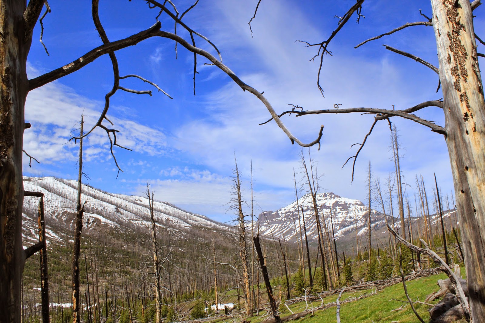
The first day we hiked about 14 miles to our campsite. The hike was mostly in burned lodgpole, but the views of the stream and surrounding mountains was beautiful. At the end of the first day, we had to ford a stream and then it started to rain. When we finally got to our site, we realized there was no bear pole, and so we had find the least dead/burned tree around to hang our gear up on.
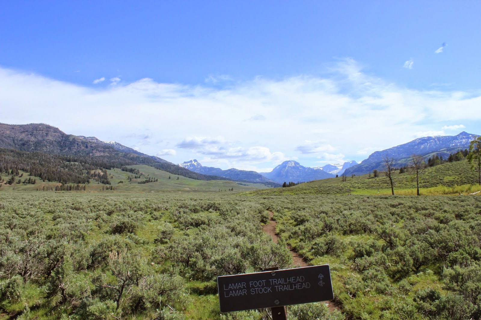
Cache Creek:

Mountains are getting closer:

The next morning the sun was shining again! Even the views from inside our tent were amazing! We felt recharged and ready to climb up to Republic Pass. We weren't sure exactly where the pass was, but we knew it was up on one of the giant mountains up ahead of us. We hoped it would be one with the least amount of snow.

Climbing up from our campsite:


The wind started picking up and the thunder started to roar. I could barely stand up the wind was so strong. We had to get off the top. Being stuck in a lighting storm at the top of a mountain did not seem like a good idea. We walked over to the other side of the pass, trying to find the trail that went down the northside of the mountain and into Cooke City, our destination. No trail was to be seen. Everything on the northside of the mountain was covered in snow, and it was steep. This meant serious avalanche potential. I walked quickly across the ridge up on the pass to see if there was another way down, but there wasn't. We decided to go for it. We walked slowly and went back and forth across the snow, hoping to not stir an avalanche. Finally, we made it to a safe, not so steep part. But there was still no trail to be seen, and now that we were in national forest, there were no trail markers anywhere. I pulled out the map and tried to figure out what to do next. Luckily there was a creek that went from where we were right into Cooke City. If that creek wasn't there, we could have been lost for hours trying to figure out which direction to go. The hike along the creek was very wet and the snow was up to our knees the entire 6 miles down. Those 6 miles felt like 12. When we finally got to Cooke City our plan was to hitchhike back to the car (hitchhiking is legal in the park fyi!). Unfortunately though, no one would pick us up for the first 5 miles! Those 5 miles felt like 20!! Eventually though, a nice couple picked us up and drove us to our car, we were VERY grateful as our legs were about to fall off after hiking 26+ miles! The views were well worth it though! :)

No comments:
Post a Comment